
Volcanic eruptions have historically caused catastrophes. Thus, we have compiled a list of the most dangerous volcanoes in the US. But do not get overwhelmed; the entire list also contains dormant volcanoes whose eruptions can be as harmless as smog and temporary air pollution.
As for the more dangerous ones, dedicated institutions constantly monitor and report minor activities.
These institutes include the US Geological Survey, the Smithsonian Institution, NASA, and the Alaska Volcano Observatory. Read the following text about their ranking, volcanic threat scores, and alert levels.
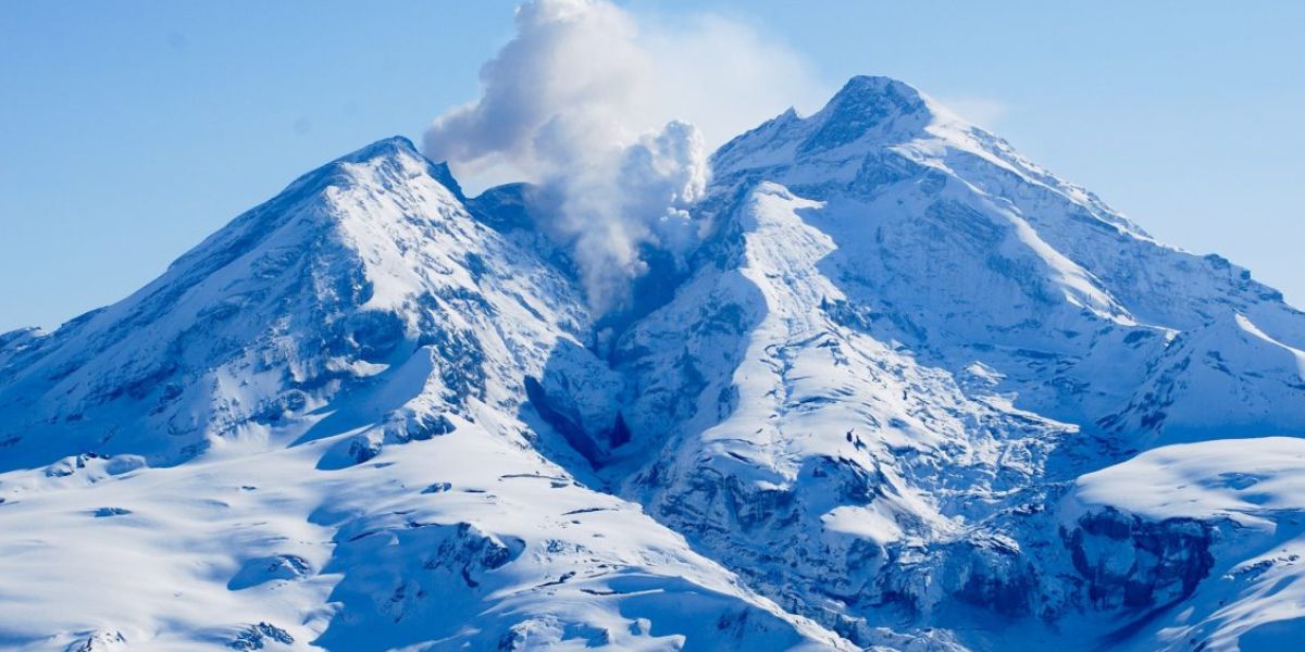
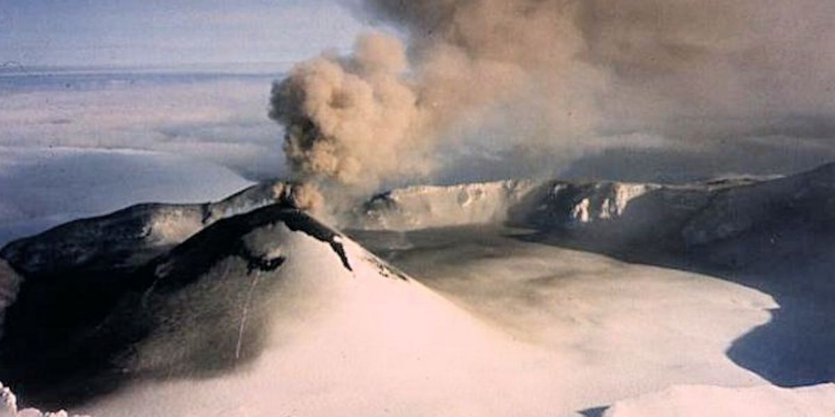
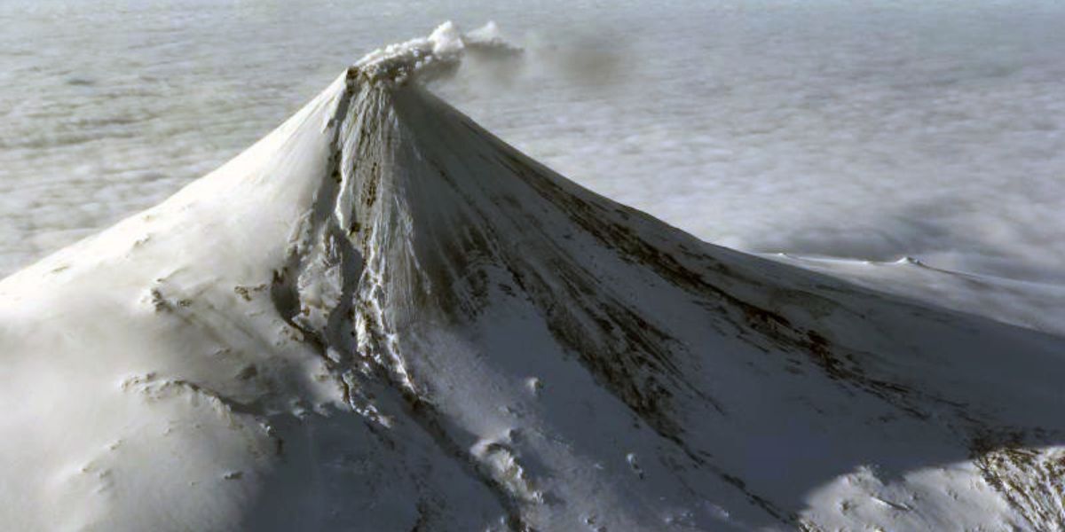
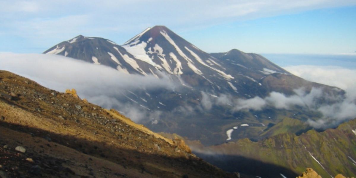
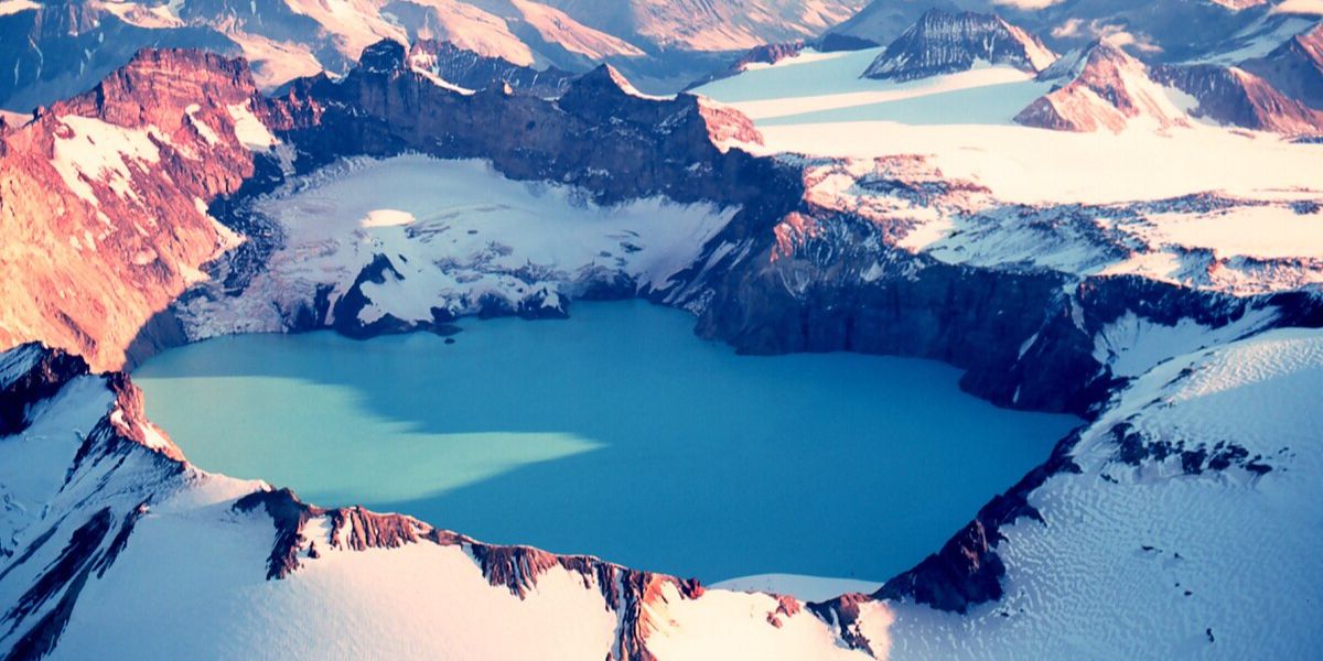
Kilauea volcano
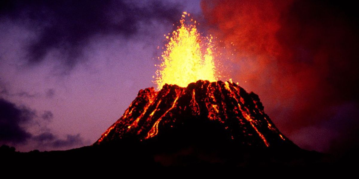
Kīlauea Volcano is currently not erupting but continues to show signs of moderate seismic and inflationary activity, indicating possible future eruptions near the summit. Recent observations include:
Seismic Activity: 50 earthquakes in the past 24 hours, mostly in the south caldera region.
Ground Deformation: Minor inflation was recorded at the summit.
SO2 Emissions: Below 200 tonnes per day, indicating low volcanic gas output.
Magma is repressurizing beneath Halemaʻumaʻu and the south caldera, causing seismic unrest.
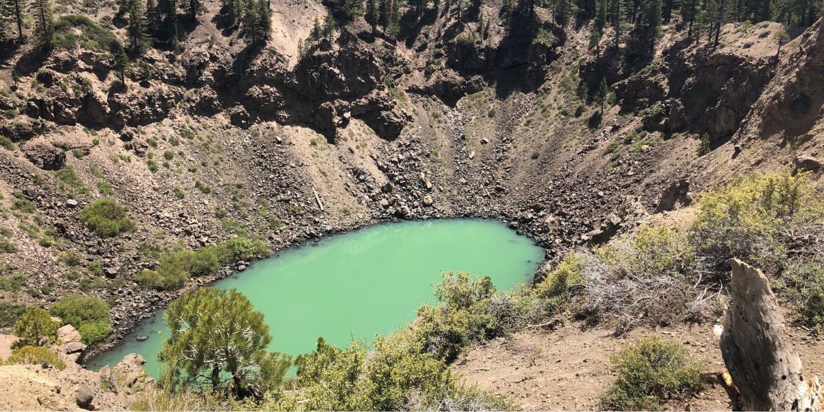
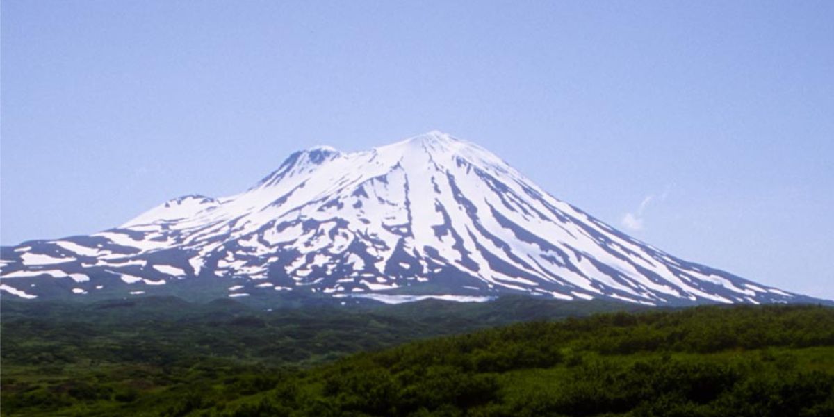
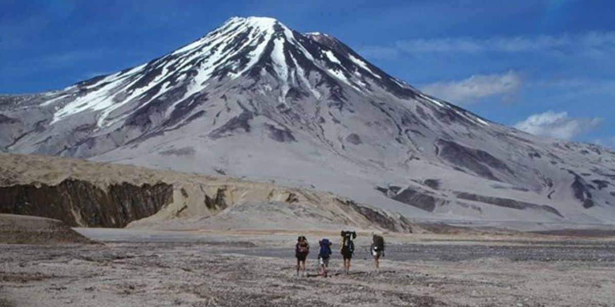
Mount Shasta
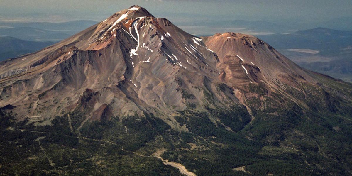
Mount Shasta’s volcanic history underwent revision when a supposed 1786 eruption was debunked. French explorer Jean-François de Galaup, comte de La Pérouse, had reported a volcanic plume that was later determined to be a grassland fire.
This revelation, part of a global effort led by Ed Venzke of the Smithsonian Institution’s Global Volcanism Program, highlights the importance of accurate historical records for predicting future volcanic activity.
Despite this correction, Mount Shasta remains a significant threat, ranked fifth among the U.S.’s most hazardous volcanoes. Recent activities indicate ongoing volcanic potential.
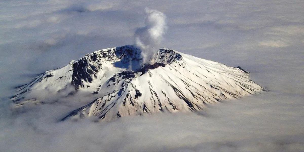
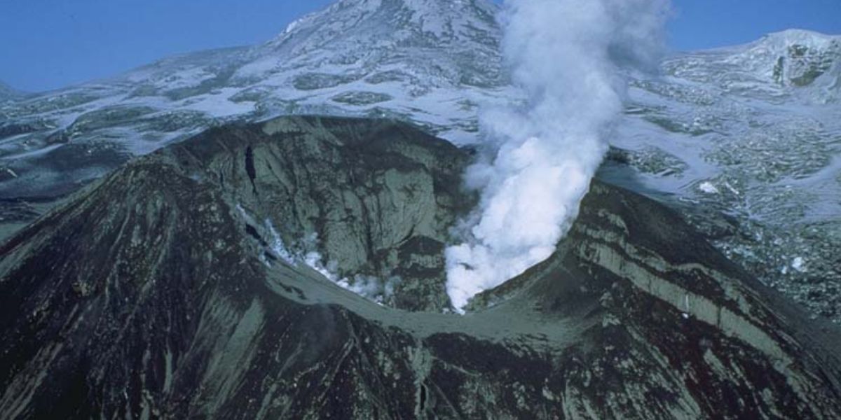
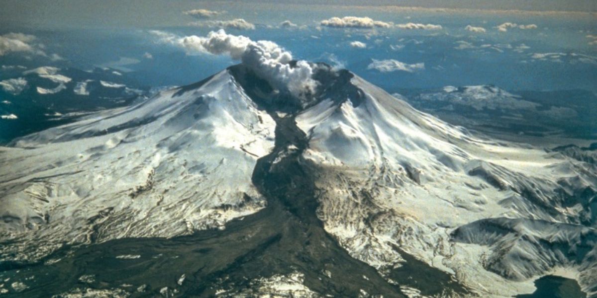
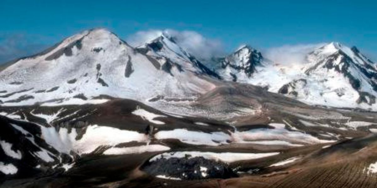
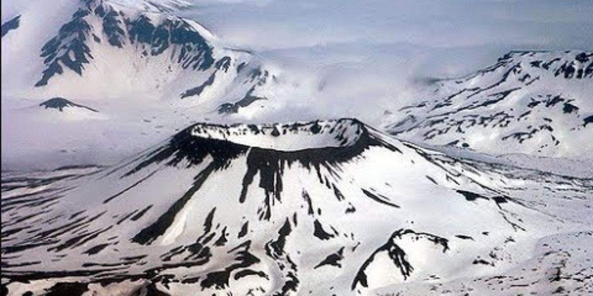
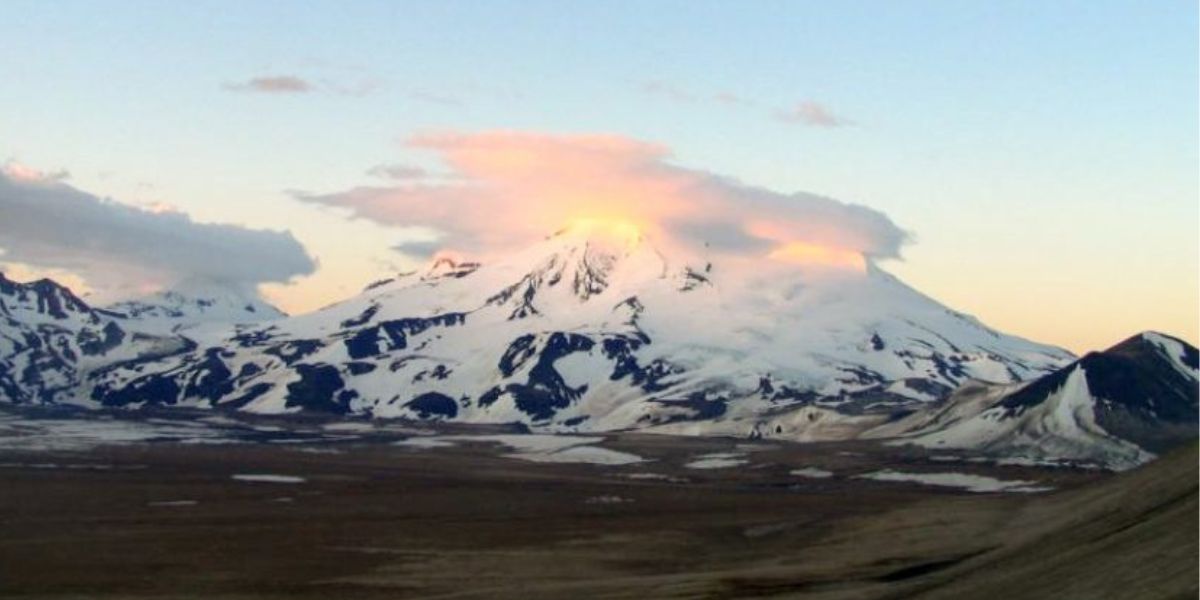
Mount St. Helens
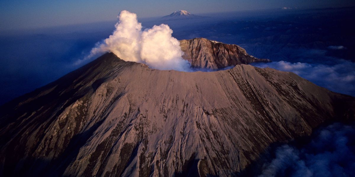
Mount Saint Helens remains an active and potentially threatening volcano in the Cascade Range of southwestern Washington.
Though it has been quieter since the major eruption on May 18, 1980, which drastically reshaped the landscape, the volcano has shown periodic signs of activity, including eruptions and seismic events.
Ongoing monitoring by scientists is crucial as future eruptions could pose significant risks to nearby communities and ecosystems.
The area around the volcano, now the Mount Saint Helens National Volcanic Monument, continues to be a site of both scientific study and public education on volcanic activity and hazards.
Mount Rainier
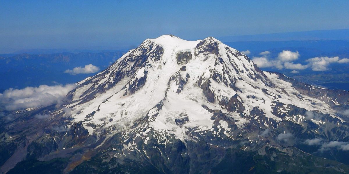
Mount Rainier, despite its calm appearance, poses a significant threat due to the potential for devastating lahars—fast-moving mudflows caused by melting snow and ice during volcanic activity.
These lahars can reach populated areas rapidly, posing a major risk to communities near Tacoma and South Seattle.
Volcanologists are particularly concerned due to Mount Rainier’s height and extensive ice cover. Enhanced monitoring and detection systems are in place, and large-scale evacuation drills are conducted to prepare residents for potential lahars.
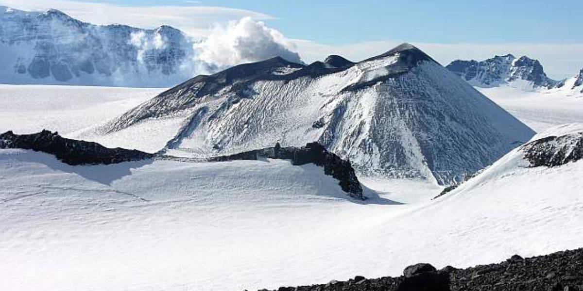
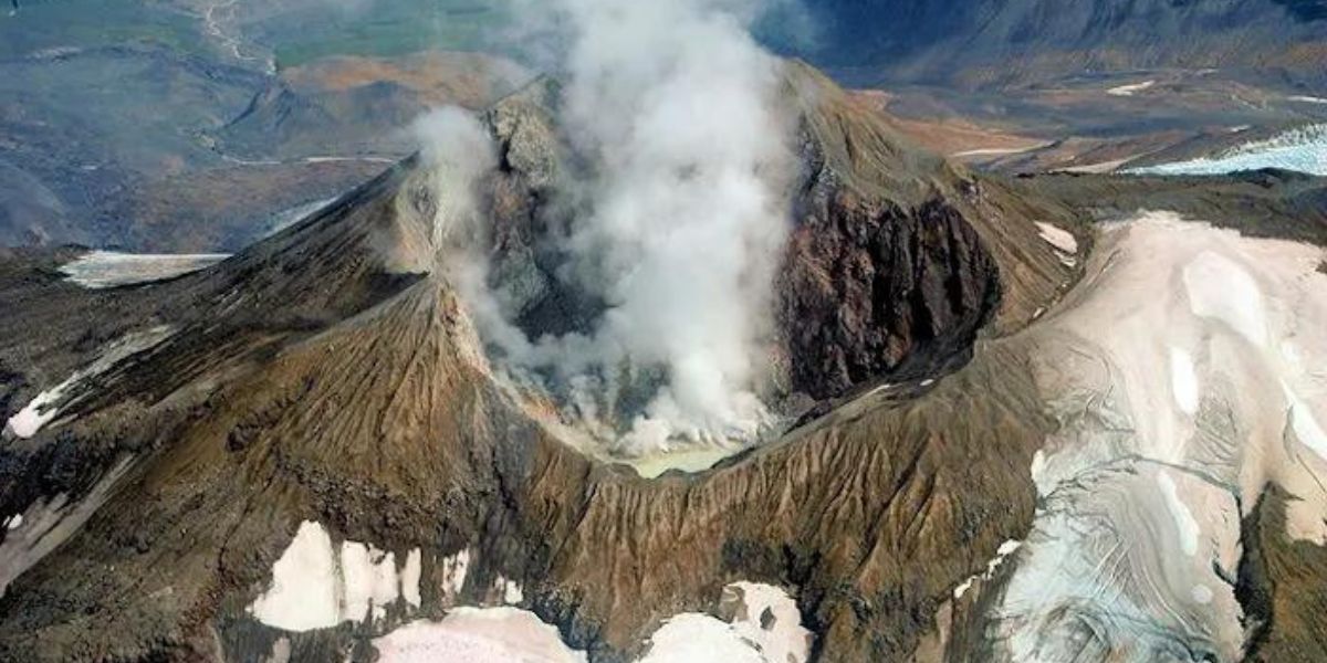
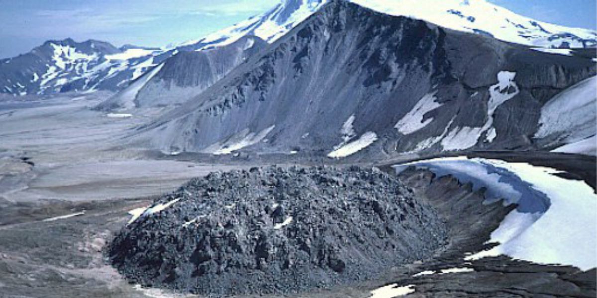
Redoubt Volcano
Redoubt Volcano is a stratovolcano in the Aleutian volcanic arc. Its heavily glaciated summit poses significant risks.
Eruptions can produce ash clouds that threaten air traffic by melting in aircraft engines, causing shutdowns. Historical eruptions have included explosive events, pyroclastic flows, and lahars, which have reached the Cook Inlet and disrupted local infrastructure like the Drift River Oil Terminal. The 1989-1990 and 2009 eruptions caused significant ashfall, affecting flight paths and causing floods.
Continuous monitoring by the Alaska Volcano Observatory is essential as Redoubt remains an ongoing threat.
Mount Hood
Mount Hood, Oregon’s highest peak at 3,426 meters (11,240 feet), lies in the Cascade Range. It is known for its volcanic activity, which is fueled by the subducting oceanic crust beneath North America. Though dormant since 1866, Mount Hood remains monitored due to its volcanic nature.
Past eruptions generated pyroclastic flows and lahars, impacting surrounding rivers. The stratovolcano features twelve glaciers, typical of the region, but these are receding due to climate change, losing 61 per cent of their volume in a century.
While currently dormant, Mount Hood is considered a potential threat and is actively studied to understand its future eruption risks and impacts.
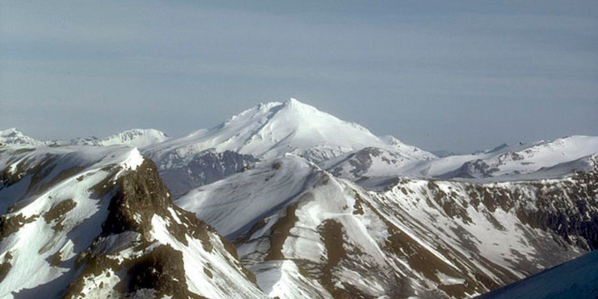
Iliamna Volcano
Iliamna Volcano, standing at 3,053 meters, is located in southwestern Cook Inlet, about 225 kilometres from Anchorage.
Although it hasn’t had confirmed historical eruptions, it emits steam and gas and experiences frequent shallow earthquakes.
Its last known eruptions occurred around 300 years ago, possibly as recently as 90-140 years ago. Prehistoric eruptions caused ash plumes, pyroclastic flows, and lahars. Potential hazards include ash clouds threatening aircraft, disrupting oil and gas operations, and triggering large lahars and flooding if ice and snow melt.
Despite its dormancy, Iliamna remains a significant threat due to these possible eruption impacts.
Mount Okmok
On 12 July 2008, Okmok Volcano in Alaska began an explosive eruption, continuing into mid-August. Ash plumes reached up to 11 km, spreading across North America and observed as far as Montana.
Seismicity indicated vigorous ash emissions, with plumes regularly reaching altitudes between 6.1 and 12.2 km. Ashfall affected nearby regions, disrupting visibility and local activities.
Lahars caused significant damage to infrastructure. Despite a decrease in seismicity in early August, intermittent ash and steam emissions persisted.
This eruption highlighted Okmok’s potential threat, particularly to air traffic and nearby communities. Due to its active status, continuous monitoring is essential.
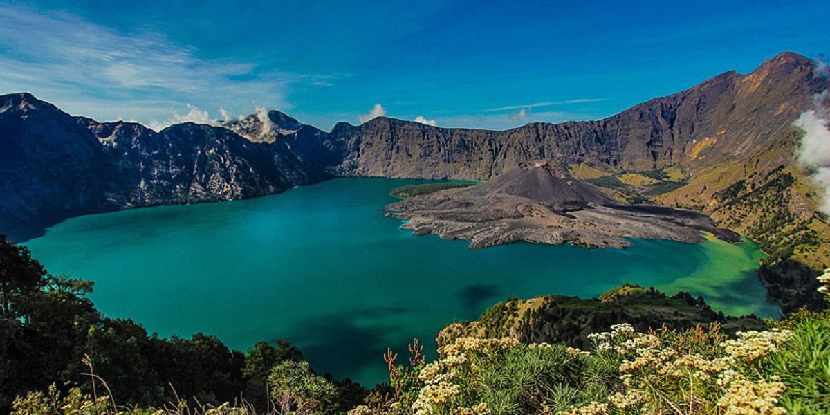
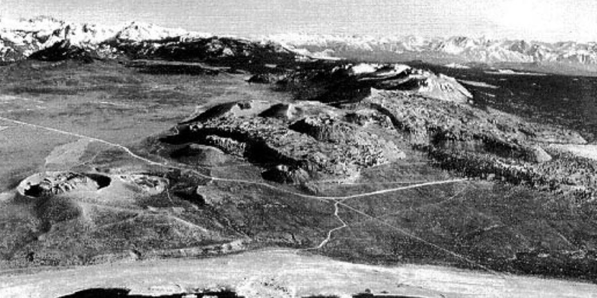
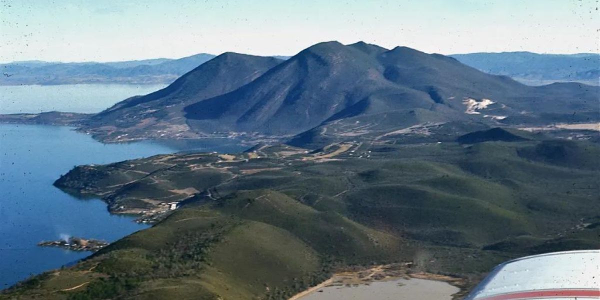
Long Valley Caldera
In the 1850s, gold fever brought European settlers to Long Valley, California, an area sculpted over 4 million years by glaciers, earthquakes, and volcanic eruptions.
About 760,000 years ago, a massive eruption formed the Long Valley Caldera, ejecting 150 cubic miles of magma.
Today, the caldera still shows activity with magma heating underground water, feeding hot springs, and driving geothermal power plants.
Since 1978, increased earthquake activity and ground swelling have indicated ongoing volcanic unrest. Though eruptions are rare, the area is closely monitored to provide early warnings and protect against potential hazards.
Crater Lake
Crater Lake, formed by Mount Mazama’s collapse 7,700 years ago, presents unique volcanic hazards due to its lake-filled caldera.
Future eruptions, with an estimated 3 in 1,000 chance over 30 years, could involve explosive interactions between magma and water, resulting in pyroclastic surges and tephra falls.
Lahars might occur if an eruption ejects lake water or melts snowpacks, mobilizing debris.
Eruptions outside the caldera could produce slow-moving lava flows and localized pyroclastic flows, though these are less likely.
Overall, the primary threat is from explosive eruptions within the caldera, necessitating close monitoring and potential area closures.
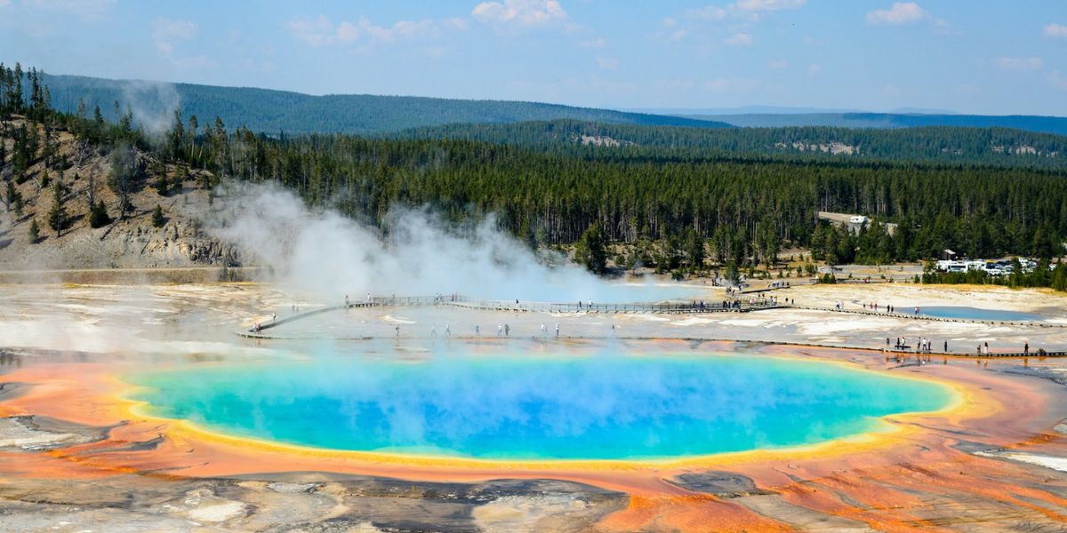
Mauna Loa
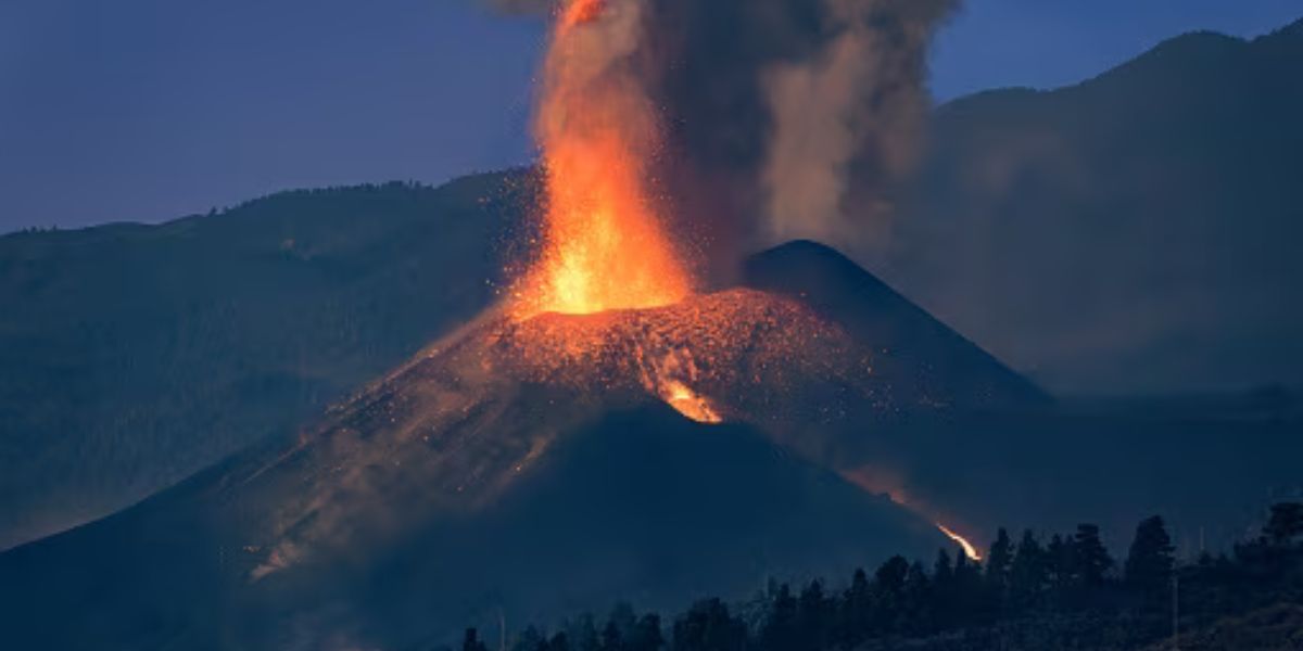 Mauna Loa, the world’s largest active volcano, erupted on November 30, 2022, for the first time since 1984. Lava, flowing at 1,000°C, currently poses minimal threat to residents. From its base on the sea floor, Mauna Loa covers half of Hawaii’s Big Island and stands taller than Mount Everest. The eruption results from magma plumes rising from a hotspot beneath the volcano.
The lava flows slowly, reducing immediate danger, but volcanic gases could create health issues. Scientists are studying this eruption to understand the volcano’s internal magma storage better.
Glacier Peak

Glacier Peak, located in Snohomish County, is one of Washington’s most dangerous yet least monitored volcanoes.
Though not as tall as other Cascade volcanoes, it has erupted explosively several times, with some eruptions significantly larger than Mount St. Helens’ 1980 eruption.
These eruptions could bury nearby communities in mudflows called lahars and disrupt regional air traffic with ash clouds.
Despite its threat, monitoring is minimal due to funding and accessibility challenges. Efforts are underway to improve monitoring and awareness, including potential funding from a new bill and the use of advanced lidar mapping to understand eruption risks better.
Three Sisters
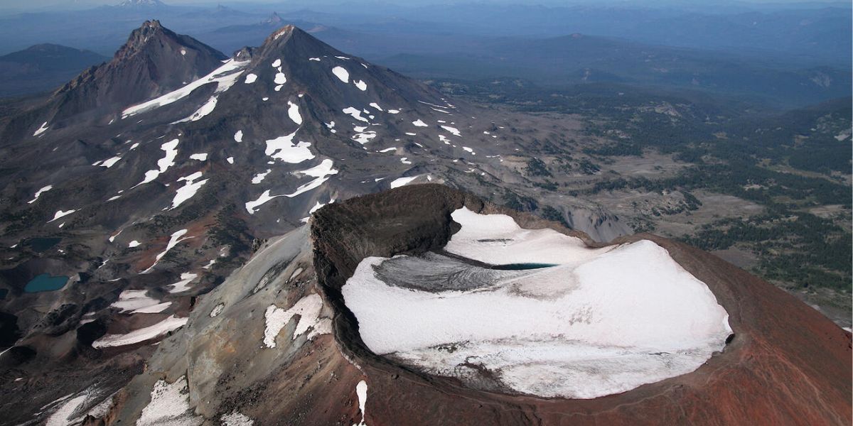
Observations at Oregon’s Three Sisters volcanic complex have shown magma movement deep underground, detected by tiny earthquakes and accelerated ground uplift over a 12-mile area.
Jon Major from the Cascades Volcano Observatory notes these signs do not indicate an imminent eruption, as more significant activity would be present if an eruption were near.
Ground uplift was measured at less than an inch over 14 months, slower than in the 1990s but faster than in the past two decades. Improved technology has allowed scientists to detect these small changes and minor earthquakes, previously undetectable.
Akutan Volcano
Akutan Volcano, a 1,100-meter stratovolcano on Akutan Island in the Aleutian Islands, Alaska, is located 1,238 kilometres southwest of Anchorage and 56 kilometres east of Dutch Harbor/Unalaska.
Since the late 1700s, it has erupted at least 27 times, mostly producing small amounts of fine ash that fell on the upper flanks and occasionally on Akutan Harbor.
The primary hazard is ash plumes, dangerous to aircraft near Dutch Harbor and Akutan Island. Future eruptions are expected to be similar to historical ones, though larger eruptions could produce significant ash, pyroclastic flows, and lahars, threatening life and property, especially in major valleys.
Makushin Volcano
Makushin volcano on Unalaska Island showed unrest from 2016 to 2020, including surface inflation detected by GNSS stations from 2016 to 2018 and an earthquake swarm in 2020 with several M4+ quakes.
Bayesian modeling indicates a 0.004 km³ magma intrusion at a depth of 5 km. Stress change analysis suggests this intrusion influenced the 2020 seismic activity.
These findings highlight the potential for future eruptions, as magma movements can increase regional stress and trigger significant seismic events, underscoring the importance of monitoring such volcanic activity for eruption risk assessment.
Mount Spurr
Mount Spurr has shown increased seismic activity since April 2024, with an average of four daily earthquakes and minor ground uplift of 1 cm since November 2023. These signs suggest a deep magma intrusion.
However, there is no immediate indication of an eruption. Historical patterns indicate that magma intrusions do not always result in eruptions, as seen in 2004. If an eruption occurs, primary hazards would include airborne ash, pyroclastic flows, and lahars. Monitoring continues to assess potential risks and provide early warnings if volcanic unrest escalates.
Lassen Volcanic Center
Increased seismic activity and ground deformation are expected before the next eruption at Lassen Volcanic Center.
Likely scenarios include an effusive eruption with lava fountains and slow-moving lava flows reaching nearby areas.
Explosive eruptions akin to Lassen Peak or Chaos Crags are also possible. The most hazardous areas are those prone to pyroclastic flows and mudflows, especially downhill from eruption sites.
Ash fallout will impact downwind regions. Risk levels within hazard zones decrease with distance from potential vents.
Newberry Volcano
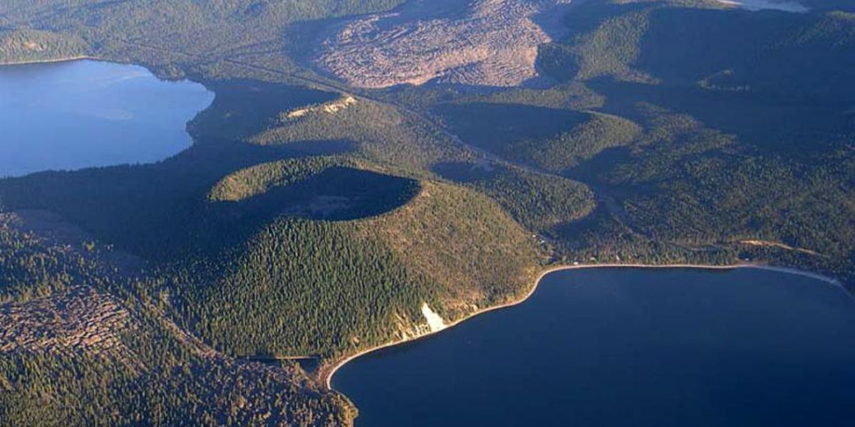
Newberry Volcano, one of the largest and most hazardous active volcanoes in the U.S., is a “very high threat”, according to the USGS, similar to Mauna Loa and Kīlauea.
Active for over 530,000 years, its most recent eruption occurred 1,300 years ago. Covering an area larger than Rhode Island, its explosive eruptions have sent ash as far as Idaho and San Francisco.
Located southeast of Bend, Oregon, Newberry features a caldera with obsidian flows and pumice beds. Despite no current unrest, future eruptions are inevitable, affirming its status among the nation’s most hazardous volcanoes.
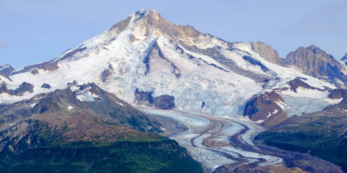
Mount Baker
Mount Baker is an active volcano that last erupted in 1843. It is mostly situated within the Mt. Baker-Snoqualmie National Forest, and its population is sparse.
However, increasing numbers of residents and recreational activities downstream and downwind pose potential risks from future volcanic hazards.
These hazards could include lava flows, pyroclastic flows, tephra falls, lahars, and flank failures. Of particular concern are flank failures and lahars, which can travel long distances into populated areas without warning.
The 2010 Mount Meager landslide in British Columbia serves as a stark reminder of the dangers posed by such spontaneous events originating from volcanic activity or natural causes.
Augustine Volcano
Research led by Kristina Walowski from Western Washington University, in collaboration with the Alaska Volcano Observatory, aims to understand Augustine Volcano’s history to predict future hazards.
Augustine, located near Anchorage, poses a significant threat due to its history of explosive eruptions, including the impactful 2006 event.
Walowski’s team focuses on analyzing past eruptions, particularly two explosive events 400 and 800 years ago, to assess potential future behavior.
By studying volcanic rocks, they infer past volcanic activity and potential future scenarios, including the threat of tsunamis from land displacement. Currently, there is no indication of an imminent eruption, but the research aims to enhance public safety preparedness in Alaska.
Mount Adams
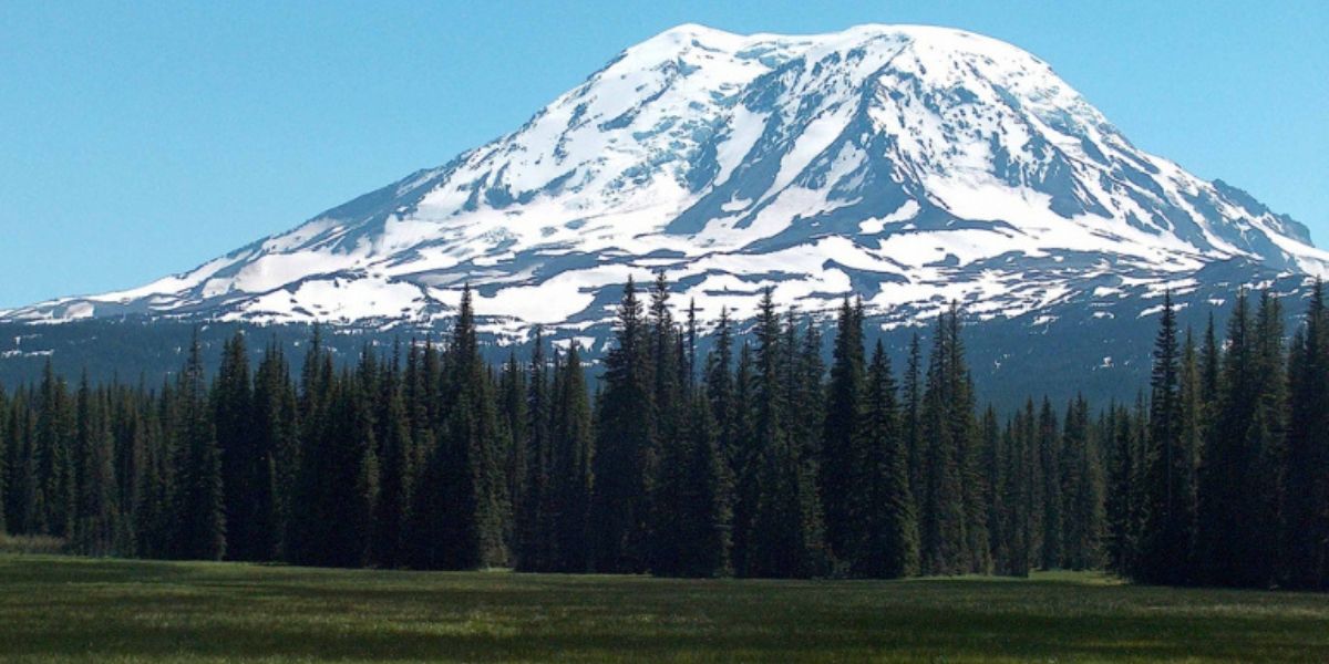
Mount Adams, like many large stratovolcanoes, poses significant hazards from landslides, debris avalanches, and lahars.
Its eruptive history has been relatively mild, with rare explosive eruptions compared to nearby Mount St. Helens. Despite this, eruptions can still be hazardous, primarily producing lava flows.
The main threat is from meltwater generated by rapid snow and ice melt, which can form destructive lahars by incorporating volcanic rock and soil. Rainstorms following eruptions can also trigger lahars and floods. Debris avalanches, and related lahars can occur without warning, especially during periods of volcanic activity or precursory earthquakes and deformation.
Veniaminof
On 8 July 2021, after restoring seismic stations, AVO changed Veniaminof’s Aviation Color Code and Volcano Alert Level to Green and Normal. Hence, the volcano’s eruption threat has significantly reduced.
The monitoring network includes seismic, infrasound, lightning detection, and satellite monitoring.
Veniaminof, a glacier-filled caldera on the Alaskan Peninsula, erupted from February to April 2021 with ash plumes and thermal activity.
Previous eruptions occurred from September to December 2018. The 2021 activity included ash emissions, small explosions, and lava flows, with ash plumes reaching up to 4.6 km high. Monitoring showed increased seismicity and sulfur dioxide emissions, which decreased after early April 2021.
Yellowstone
A new study reveals that the magma chamber beneath Yellowstone’s supervolcano contains significantly more melted rock than previously estimated.
Despite this, researchers assure there is no imminent eruption threat. The study, led by Sin-Mei Wu, used seismic wave data to analyze the upper magma reservoir’s composition, finding it consists of 28% melt, higher than the 16-20% found in a 2022 study.
This reservoir, located about 3 miles deep, includes a mix of solid rock, semi-liquid crystals, gases, and other substances. Understanding these proportions can help assess eruption risks in other volcanic systems.
Mono-Inyo Volcanic Craters
Eruptions of the Mono-Inyo volcanic chain involve multiple hazards. Minor tephra accompanies explosions and vent openings, while lava flows can destroy everything in their path, including roads and infrastructure. Volcanic gases also pose a risk. The most dangerous hazards are pyroclastic flows and surges.
These fast-moving avalanches of hot ash, pumice, rock fragments, and gas can travel up to 100 km/h and reach temperatures over 500°C, burning everything in their path.
Scientists study past pyroclastic flow distances to predict future hazards. They focus on the south moat of Long Valley, an area of significant earthquake activity and ground deformation.
Pyroclastic flows and surges could extend up to 15 km from new vents, but precise predictions remain challenging.
Great Sitkin Volcano
Great Sitkin Volcano, at 52°4’35” N and 176°6’39” W with a summit elevation of 5709 ft (1740 m), remains at an alert level of watch with an aviation colour code of orange.
The slow lava eruption at the summit continues, with minor earthquakes detected recently.
Cloud cover has obscured satellite and web camera views. This eruption has been ongoing since July 2021, with no explosive events since May 2021. Monitoring includes seismic and infrasound sensors, web cameras, and satellite data.
Shishaldin Volcano
Shishaldin Volcano, at 54°45’19” N and 163°58’16” W with a summit elevation of 9373 ft (2857 m), is at an alert level of advisory with an aviation color code of yellow.
Minor unrest continues with small earthquakes and seismic tremors.
Cloud cover has limited satellite and web camera views. Minor rock falls and dust clouds may occur.
The last significant ash eruption was in November 2023. Monitoring uses local and regional networks, infrasound data, and satellite images.
Kanaga Volcano
Volcanic unrest at Kanaga Volcano, located at 51°55’27” N and 177°9’44” W with a summit elevation of 4288 ft (1307 m), has subsided, reducing the Aviation Color Code to GREEN and the Volcano Alert Level to NORMAL.
Seismicity, elevated after a small explosion and ground-cracking event on December 18, 2023, has returned to background levels.
Satellite data show no recent surface changes, elevated temperatures, or gas emissions. Intermittent steaming from a crack near the summit crater is occasionally observed.
Monitoring includes local seismic and infrasound sensors, web cameras, regional networks, and satellite data.
Gareloi Volcano
Gareloi Volcano, located at 51°47’21” N and 178°47’46” W and with a summit elevation of 5161 ft (1573 m), was at an advisory alert level with an aviation colour code of yellow. The alert level has now been changed to normal.
Slightly elevated seismicity with small low-frequency earthquakes has been observed, though this is common for Gareloi. Recent satellite and web camera observations were obscured by clouds and showed no activity.
The persistent emission of magmatic gases from a fumarole field on the south crater and low-level seismic activity continues. The increased seismicity likely indicates changes in the magmatic-hydrothermal system, but the eruption likelihood remains unclear.
Just like the other volcanoes in the US, this particular one’s monitoring also includes local seismic and infrasound networks, satellite data, and regional detection systems.
Mount Wrangell
The Alaska Volcano Observatory (AVO) has moved the alert level and aviation colour code for Mount Wrangell to ‘unassigned’ due to a station outage that prevents seismic monitoring. Previously, the alert level was normal and the aviation color code was green. AVO will rely on satellite, regional infrasound, lightning data, and observer reports to detect any eruptive activity.
Mount Wrangell, a 14,163 ft (4317 m) andesitic shield volcano with an ice-filled summit caldera, is located in Wrangell-St. Elias National Park. It has three geothermally active post-caldera craters and occasional steam emissions. It is 330 km northeast of Anchorage.
Pavlof Volcano

Eruptive activity at Pavlof Volcano has ceased, with seismicity returning to background levels and no explosions detected since December 11, 2022. Intermittent weakly elevated surface temperatures and minor steaming from the recently active vent are observed, indicating cooling lava.
Consequently, AVO lowered the alert level to normal and the aviation color code to green on January 20. Pavlof, a snow- and ice-covered stratovolcano, is 592 mi (953 km) southwest of Anchorage.
With a history of over 40 eruptions, Pavlof is one of the most consistently active volcanoes in the Aleutian arc. Its eruptions typically involve sporadic Strombolian lava fountaining lasting several months.
Past eruptions have generated ash plumes as high as 49,000 ft (15 km), impacting areas as distant as eastern Canada during the March 2016 event. Despite the current lull, Pavlof’s eruption history suggests that eruptive activity can escalate quickly with little warning, highlighting its ongoing threat to nearby communities like King Cove, located 30 mi (48 km) southwest of the volcano.
Takawangha Volcano
Takawangha volcano, situated on Tanaga Island’s northeastern tip in the Andreanof Islands, is 1,449 meters (4,754 feet) tall.
It is currently under Advisory alert with a Yellow Aviation Color Code due to recent seismic activity, including 13 minor earthquakes below magnitude two over the past, mostly shallow. Satellite observations show no volcanic activity. Takawangha’s summit, largely ice-covered, features four young craters indicating past ash and lava eruptions.
The volcano’s structure includes hydrothermally altered sections prone to potential debris avalanches. Although historically dormant, recent research suggests it may have been mistakenly attributed to nearby Tanaga volcano’s eruptions.
Semisopochnoi volcano
Semisopochnoi volcano, situated on the largest young volcanic island in the western Aleutians, stands at 800 meters (2625 feet) tall. Currently under a Watch alert with an Orange Aviation Color Code, the volcano has shown ongoing activity centred at Mount Young’s north crater.
This includes elevated seismicity, weak tremors, and minor explosive events detected via seismic and infrasound signals.
Persistent steam plumes rising up to 5000 feet above sea level have been observed previously.
Although no ash emissions were noted in clear webcam views, sporadic eruptions since 2018 have typically produced ash below 10,000 feet. Semisopochnoi is monitored extensively with local sensors, satellite data, web cameras, and regional networks. The island is uninhabited and part of the Alaska Maritime National Wildlife Refuge.
Hualālai
Hualālai, Hawaii’s third most active volcano, is classified as a “high threat” by the USGS due to its frequent eruptions and proximity to developed areas.
While the timing of its next eruption is unknown, past behaviour provides clues. The predominant threat is lava flows, with eruptions clustering in time, separated by centuries of inactivity. The most recent eruptions ended in 1801.
Comparing Hualālai’s Ka‘ūpūlehu lava flow to Mauna Loa’s 1984 eruption suggests future lava flows could reach the ocean in less than a day. Monitoring is ongoing to detect any eruption precursors.
Pagan Islands
Pagan Island is the largest and one of the most active volcanoes in the Mariana Islands. It’s composed of Basalt and Andesite. And according to National Volcano Early Warning System, it has a high threat potential.
It features two stratovolcanoes linked by a narrow isthmus. North and South Pagan stratovolcanoes were formed within calderas that are 7 km and 4 km in diameter, respectively.
Mount Pagan, standing 570 meters high at the northeastern end, rises above the flat floor of the northern caldera, which likely formed less than 1,000 years ago. South Pagan, reaching 548 meters high, has an elongated summit with four distinct craters. Historical eruptions, primarily from North Pagan, have been recorded since the 17th century. The most significant eruption occurred in 1981, leading to the evacuation of the island’s sparse population.
Katmai Volcano
Katmai volcano, a 10 km diameter stratovolcano, features a central lake-filled caldera with a rim reaching 2047 m and a floor at about 995 m. Located near the Novarupta dome, the source of the 1912 pyroclastic flows, Katmai is composed mainly of lava flows, pyroclastic rocks, and airfall deposits.
The Quaternary volcanic rocks are under 1500 m thick, and the volcano is covered by snow and ice, with glaciers extending from its flanks.
Built on Late Jurassic Naknek Formation sedimentary rocks, it poses a significant eruption threat. But its color code is green and alert threat normal. The name “Mount Katmai” was established in 1913.
Mount Peulik
Mount Peulik is a small, truncated stratovolcano with a basal diameter of about 10 km, located near Becharof Lake on the Alaska Peninsula. Rising to an elevation of 1474 m (4835 ft), it lies just north of the Aleutian Range’s main axis and is built on Jurassic sedimentary rocks.
The summit crater, about 1.5 km in diameter, is breached on the west side and contains a dome about 0.5 km in diameter. This dome has produced block-and-ash flows covering about 40 square km.
The volcano partially overlaps the Ugashik caldera and has additional smaller domes. It poses an eruption threat and is seismically monitored with a green color code and a normal alert level. Nearby towns include Kanatak (18 mi SE) and Ugashik (41 mi SW).
Trident Volcano
Trident Volcano, officially known for its distinctive three-peaked structure, is actively monitored with a green color code and normal alert level.
It rises to 1864 m (6115 ft) on the Alaska Peninsula, positioned at 58.2343° latitude and -155.1026° longitude. The volcanic complex includes three stratovolcanoes and numerous domes, such as Cerberus and Falling Mountain, aligned along a northeast-southwest volcanic front. Notably, a new fragmental cone began forming on the southwest flank in 1953.
Trident poses an eruption threat due to its active monitoring and the potential for volcanic activity in the region. Nearby communities include Karluk (52 mi SE), Kanatak (57 mi SW), and Larsen Bay (63 mi SE), with Anchorage located approximately 274 mi (441 km) away.
Clear Lake
Currently, the Clear Lake Volcanics area is experiencing a period of relative quiescence following a highly active phase between 60,000 and 10,000 years ago, averaging one eruption every 1,800 years.
The region’s volcanic history spans 2 million years and is characterized by episodic activity with long periods of dormancy interrupted by shorter intervals of frequent eruptions.
Despite the current lull, intermittent seismic activity and subsurface heat suggest ongoing volcanic activity, making future eruptions likely. An eruption from the Clear Lake magma chamber could lead to phreatomagmatic events in the lake, posing ash-fall and wave hazards along the lakeshore and ash-fall risks within a few kilometres of the vent.
Eruptions away from the lake might produce hazardous silicic domes, cinder cones, and flows within a similar radius. Increased earthquake activity would likely precede any future eruptions.
Aniakchak
Aniakchak is under observation for potential volcanic eruptions.
On February 22, 2023, the Alaska Volcano Observatory (AVO) raised the Aviation Color Code and Volcano Alert Level for Aniakchak to yellow/advisory due to increased seismicity.
Earthquakes beneath Aniakchak have become more frequent and shallower. Background seismicity has typically involved deep, long-period events at a rate of ~4 per month, but from October 2022, the rate has risen with shallower quakes.
From January 31, 2023, dozens of daily earthquakes have been detected, including a M3.7 quake on February 17. There is no indication of an imminent eruption, but future signs of unrest may include gas emissions, elevated temperatures, and surface deformation. An eruption threat remains, as similar seismic increases at other volcanoes have occasionally led to eruptions.
Mount Churchill
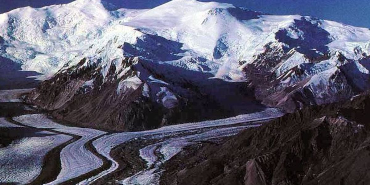
The Bona-Churchill massif in the St. Elias Mountains features a 2.7 x 4.2 km summit caldera, the source of the White River Ash from two of North America’s largest explosive eruptions in the last 2,000 years (McGimsey et al., 1992). Mount Bona’s summit is 4 km from the younger Mount Churchill. Initially, the source vent of the White River Ash, covering over 340,000 km² of eastern Alaska and NW Canada, was thought to be a pumice mound under the Klutlan Glacier NE of Churchill. Later findings identified thick pumice deposits on the caldera rim similar to the White River Ash.
A second major eruption from Churchill’s caldera created the eastern lobe of the White River Ash, extending over 1,000 km east. Tree rings from spruce killed by this eruption date it to 833-850 CE, correlating with AD860B ash in Greenland and Europe (Jensen et al., 2014) and dated by Coulter et al. (2012) at 846-848 CE.
Earlier radiocarbon ages by Clague et al. (1995) placed this eruption at 803 CE, and Lerbekmo et al. (1975) dated it around 1,250 BP.
In the present day, the eruption threat is significantly low.
Anatahan
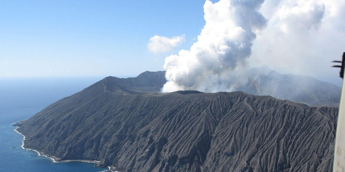
Anatahan is a volcanic island in the central Mariana Islands. It features a large stratovolcano with a 2.3 x 5 km summit caldera. Its first recorded eruption occurred in May 2003, forming a new crater in the eastern caldera. The island’s sparse vegetation indicates recent lava flows of the Holocene age. A submarine volcano, NE Anatahan, lies on its northeast flank.
Given its history and geological features, Anatahan poses a significant eruption threat, with potential explosive activity that could impact the region. The island’s volcanic activity is monitored closely for any signs of imminent eruptions.
On March 30, 2005, Anatahan Volcano in the Northern Mariana Islands, north of Guam, emitted two distinct plumes of steam and ash. The volcano had been intermittently erupting throughout much of 2005. The emissions created vog, which can cause breathing difficulties and eye irritation for nearby residents and pose a threat to aviation by clogging jet engines.
Anatahan continued to emit steam following its largest recorded eruption on April 6, 2005, part of its third historical eruption that began in January 2005. The volcanic activity has affected Guam and nearby islands with volcanic haze.
Agrigan
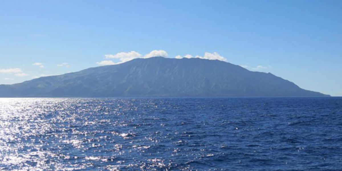
Agrigan (Agrihan), the highest volcano in the Marianas arc, features a 500-m-deep, flat-floored caldera on its 965-m-high summit. This stratovolcano, composed of basalt and andesite, last erupted in 1917, depositing ash and lapilli up to 3 meters thick on the island’s southeast coast. The elliptical island spans 8 km and rests atop a massive 4000-m-high submarine volcano, the second largest in the Marianas.
Agrigan’s caldera, 1 x 2 km wide, is breached to the northwest, with lava flows extending to the coast and forming a delta. Radial valleys dissect its densely vegetated flanks, highlighting its high threat potential according to the National Volcano Early Warning System.
Mount Griggs
Mount Griggs, located in the Katmai district of Alaska, is a stratovolcano notable for its truncated summit and complex crater system.
Rising 1,700 meters above the Valley of Ten Thousand Smokes, it features three concentric craters, the outermost breached to the southwest and partially filled with ice.
The volcano’s main outer crater likely formed during an early Holocene collapse, triggering a large debris avalanche. Mount Griggs is composed primarily of olivine-pyroxene andesites, distinct from neighbouring volcanoes in composition and isotopic signatures. Active fumaroles emit SO2-rich gases and construct sulfur mounds, with temperatures ranging from 96°C to 108°C, but it does not presently pose an eruption threat.
Monitoring of its volcanic activity continues, but based on current observations and historical data, there are no imminent signs of an eruption.
The volcano was named in honour of Robert Fiske Griggs, a botanist whose expeditions led to the establishment of the Katmai National Monument in 1918.
Hayes
Hayes Volcano, located in Alaska’s Tordrillo Mountains, is atypical among Aleutian Arc volcanoes, lacking a defined cone and mostly covered by glacial ice and snow.
It was only identified as a volcano in 1975 and is primarily composed of eroded lava domes, dome debris, and pyroclastic flow deposits. Despite its remote and rarely visited status, Hayes Volcano is classified as posing a “high threat” according to the USGS National Volcanic Threat Assessment.
Although it has not erupted in recorded history, prehistoric eruptions, such as those around 1850-1550 BCE, deposited ash across interior Alaska, affecting areas like Anchorage and Skwentna.
Future eruptions could severely disrupt air traffic at Ted Stevens International Airport, cut off access to interior Alaska, threaten public health, and impact environmental and economic activities in Cook Inlet.
Moreover, the volcano’s ice cover makes it prone to generating lahars that could affect communities downstream, such as Skwentna.
Mount Mageik
Mount Mageik, though historically active with eruptions during the Holocene period, currently poses a low eruption threat. Its last confirmed eruptions occurred during that time frame, with reports of activity between 1927 and 1946 considered uncertain.
The volcano’s eastern summit cone was the source of several Holocene lava flows and explosive activity, including the formation of a 300-meter-wide explosion crater around 2,400-2,500 years ago.
This crater now holds a shallow acidic lake and numerous superheated fumaroles. Despite its volcanic history, ongoing monitoring indicates no recent signs of unrest or imminent eruption from Mount Mageik.
Mount Martin
Mount Martin, a 6,050-foot peak 11 miles southwest of Mount Trident, has been active in the Aleutian Range and poses an eruption threat. Its activity has sometimes been mistakenly attributed to the nearby Mount Mageik.
Notable events include ashfall at Kukak Bay on July 22, 1951, and eruptions concurrent with Mount Trident’s activity in February 1953, likely originating from Mount Martin.
However, these reports are incorrect, attributing them to the mountain’s persistent steam plume, which often rises 600 meters above the vent and extends 20 km downwind.
Novarupta
Novarupta, a volcanic vent and lava dome in Katmai National Park, Alaska, erupted violently on June 6, 1912, for 60 hours, making it the largest volcanic eruption of the 20th century. The eruption ejected about 28 cubic km of tephra 32 km into the stratosphere, depositing ash up to 30 cm deep over 7,800 square km.
The blast transformed a green valley into the Valley of Ten Thousand Smokes and filled Knife Creek’s valley with 200 meters of ash and rock. Ashfall buried Kodiak, Alaska, and was heard 1,200 km away in Juneau. The eruption devastated local wildlife and caused lasting ecological damage.
Today, Novarupta and the Katmai region still pose a significant eruption threat. The area remains volcanically active, with potential eruptions threatening air travel and local communities. A future eruption could disrupt aviation, affecting North Pacific air traffic and causing severe ecological and economic consequences similar to those of 1912.
Mount Dutton
Mount Dutton is a small, snow- and ice-covered volcanic centre in Alaska, approximately 5 km in diameter and 7-15 cubic km in volume.
It sits on altered Tertiary volcanic rocks, featuring a complex of multiple domes where newer ones have displaced older ones. Hydrothermal alteration occurs between domes, and dome-building has caused extensive destruction of cone-building lava flows, resulting in thick debris flows around the central complex.
A 300 m high headwall scarp forms on the west summit, with debris avalanches down both sides. The volcano’s east flank shows slightly dissected debris and pyroclastic flows. Eruption threats persist, impacting nearby areas and potentially causing significant local damage.
Westdahl Volcano
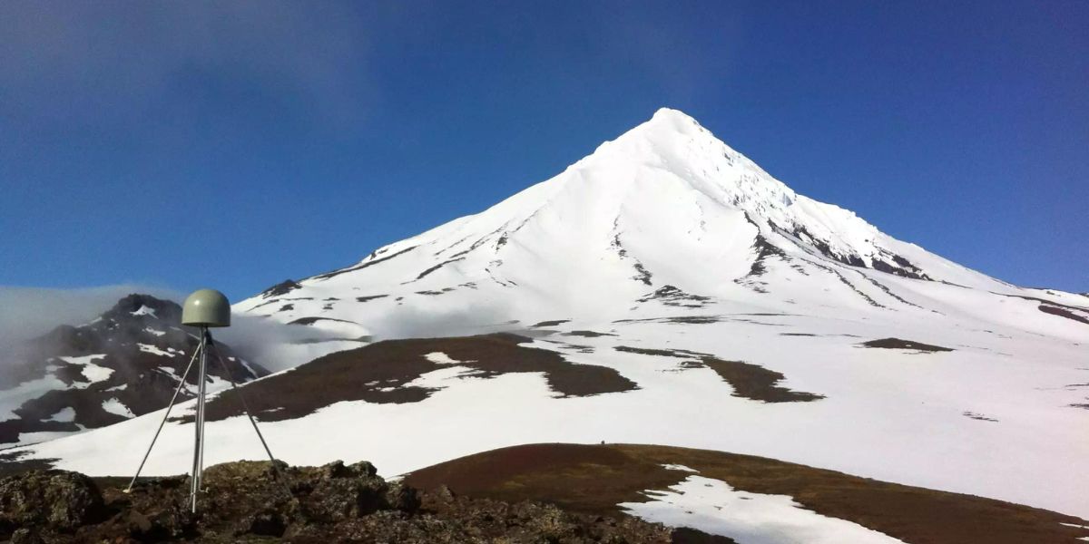
Westdahl volcano, located at 54°31’2″ N 164°38’51” W with a summit elevation of 5,118 ft (1,560 m), currently holds a Volcano Alert Level of normal and an Aviation Color Code of green.
Recently, the Alaska Volcano Observatory (AVO) has restored real-time seismic monitoring, enabling active surveillance of seismic activity at the volcano. This upgrade signifies improved readiness to detect any signs of a potential eruption.
AVO will continue monitoring seismic, satellite, infrasound, and lightning data, along with reports from pilots and ground observers, to promptly identify any emerging eruptive activity and ensure public safety in the region.
Alamagan
Alamagan, located in the central Mariana Islands at 17.6° N latitude and 145.83° E longitude, is an emergent summit of a large stratovolcano. It features a summit crater approximately 350 meters deep, situated east of the island’s centre. The volcano, composed of andesite to basalt, last erupted around 870 CE.
It poses a moderate threat potential according to the National Volcano Early Warning System. Alamagan’s exposed cone is primarily Holocene in age, with a southwest flank cut by a 1.6 x 1 km graben. Historical eruption reports have been deemed invalid, although pyroclastic-flow deposits from about 1000 years ago are dated.
Finally, the government is undertaking rather ambitious measures to prevent tragedies from volcanic eruptions. NASA is heading one of these mega projects.
NASA has proposed a bold plan to mitigate the threat posed by supervolcanoes, particularly the one lurking beneath Yellowstone National Park.
This supervolcano, which erupts catastrophically approximately every 600,000 years, poses a significant risk to global food supplies and human civilization. NASA’s concept involves drilling into the magma chamber of the supervolcano and injecting water at high pressure to extract heat, thus potentially preventing an eruption. This method could also generate geothermal energy, offering a dual benefit of mitigating risk and providing sustainable power.
However, the project is not without risks, as drilling into the magma chamber could inadvertently trigger an eruption.
Therefore, careful planning and cautious execution are crucial to avoid unintended consequences and ensure the project’s safety and effectiveness over the long term.
Thankfully, most of these volcanoes have remained dormant for a while, so hopefully, we will not see an eruption any time soon.